


Jakarta, Ekuatorial – Lack of accurate mappings on lands and oceans had triggered conflicts in the country, said a senior official on Tuesday (9/9), in Jakarta. Geospatial information is crucial to determine forest area stipulation, set up boundaries, spatial planning, legal certainty on land ownership, disaster risk reduction, even to observe earth’s changes. Unfortunately, only […]
Category: Forests
Southeast Sulawesi police confiscated 250 illegal teak logs
Southeast Sulawesi police confiscated 250 illegal teak logs on Tuesday (9/8) after the truck driver failed to show legal documents. The driver, who was named as a suspect, was arrested at an industrial forest area located in Matabubu Jaya village, Konsel district, Southeast Sulawesi. Read full article on sultranews.com
Government of North Buton Provide 10 Thousand Hectares of Sugarcane Plantation
The Government of North Buton District prepared 10 thousand hectares of land for sugarcane plantations in the District of West Kulisusu, Bonegunu and partly Kulisusu. The land comes from the community garden, otheh area usage (APL) and convertible production forest (HPL). “The entire site has been prepared and met the requirements, even when the community […]
WALHI Will Sue Aceh Goverment
Director of WALHI in Aceh, Muhammad Nur firmly said that WALHI will sue the Aceh Governor Zaini Abdullah because they don’t run the law No. 18 year 2013 about the Prevention and Eradication of Forest Destruction. “The illegal miners freely use protected areas, other cases of road infrastructure development in the protected forest areas has […]
South Barito appointed as customary forest mapping pilot project
Jakarta, Ekuatorial – South Barito of Central Kalimantan has been appointed as the first pilot project for forest recognition project by third party aimed to manage the province’s overlapping permit issuance, said a member of government’s office, in Jakarta, last month. The Third Party Recognition and Verification Program, locally shorten as PPH, is conducted by […]
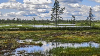
Only 0,6 Percent Of Peatland Are Used In Papua
Although Papua has a peatland area about 3.2 million hectares from 14.9 million hectares in Indonesia, but only 0.6 percent were used now. “It means that only 600 thousand hectares of peatland were used now. Papua are still safe, Now we have to finds out how we manage the peatland for the welfare, but not […]
BIG Launched Participatory Mapping Application
Jakarta, Ekuatorial – Geospatial Information Agency in Jakarta, yesterday (25/8) launched the participatory mapping application. The application is designed with a very user-friendly interface, it is expected to invite community participation independently. “Geospatial Information Agency encourages public participation to independently map out their environments, “said Asep Karsidi, Head of Geospatial Information Agency (BIG). Elements that […]
80 Percent of Potential Mine In Center Aceh Located In The Forest
Field to Forest Protection, Forest Service Central Aceh, Zulfan, said, 80 percent of the potential of mining in the district was in the forest. “If the mine area were all in the woods, this is very dangerous and can have an impact on society and the environment if not managed properly,” said Zulfan. Read full […]
Kendari Bay In The Grip Of Mafia Land
The practice of land mafia is alleged to have made a loss of most of the area in Kendari bay area. On the south side of the bay Kendari for example, the area that was once filled with mangrove is now displaced and become a ponds and construction of buildings. Read full text on Suarakendari.
Aceh Government Will Rehabilitate Tripa Swamp
Head of the Aceh Forest Service, Husaini Syamaun expressly said in the directives of the Aceh Governor, the status of Tripa Swamp which has been damaged will be rehabilitated. “While the remaining forest will be maintained,” said Husaini. Read full text on Acehterkini.