For decades, the collective memory of forest and land fires in Indonesia has been intrinsically linked to the dense, choking smog rising from the peatlands of Sumatra or the massive deforested tracts in the heart of Kalimantan. This narrative has been so deeply ingrained that we often overlook the archipelago’s eastern frontiers. However, in the first half of 2026, satellite data captured a massive and anomalous shift: the epicenter of the flames is no longer dominated by the wet rainforests of the west, but has aggressively spread to the dry savannas of East Nusa Tenggara (NTT).
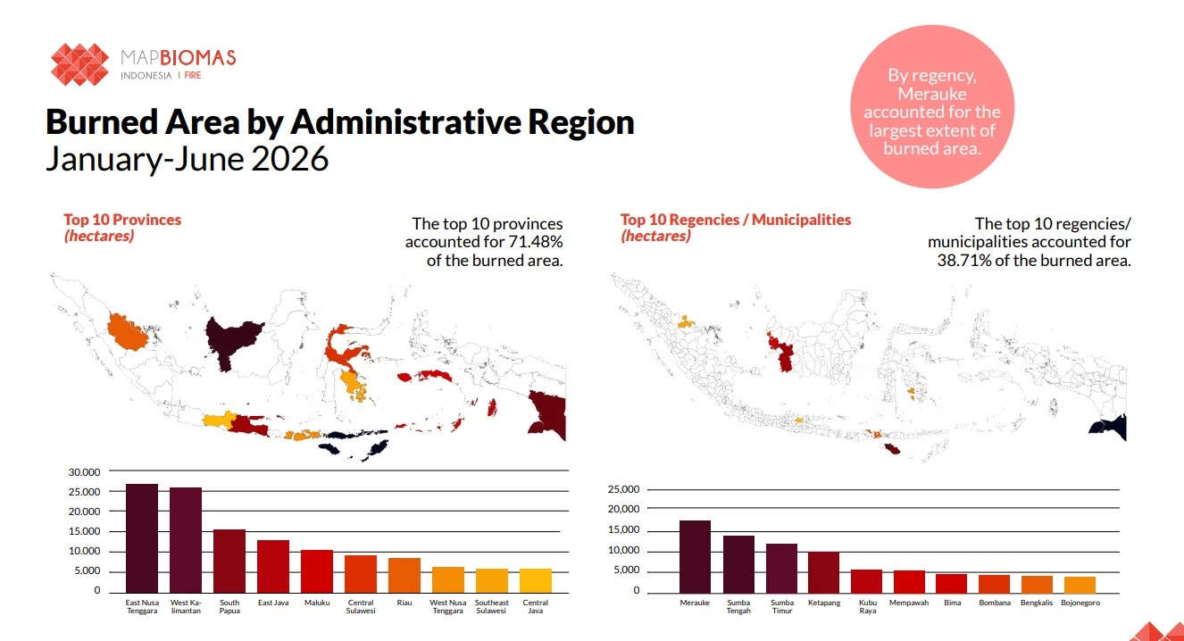
According to a recent analysis by MapBiomas Fire, NTT recorded the largest total burned area of any province in Indonesia between January and June 2026. This phenomenon serves not only as a stark anomaly but also as an urgent warning that the climate crisis and land fires have encroached upon landscapes that traditionally fall outside the government’s primary monitoring priorities.
A Shifting National Fire Map
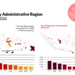
Throughout the first semester of 2026, MapBiomas Fire recorded a staggering 178,232 hectares of burned land across Indonesia. Of this vast expanse, NTT contributed the largest share, with the burned area reaching 26,591 hectares.
The devastation in NTT slightly edged out West Kalimantan, a province historically plagued by fires, which recorded 25,629 hectares of burned land. This crucial finding highlights a new reality: in early 2026, forest and land fires were no longer concentrated solely in Sumatra and Kalimantan—the regions that have historically monopolized the country’s fire mitigation efforts and resources.
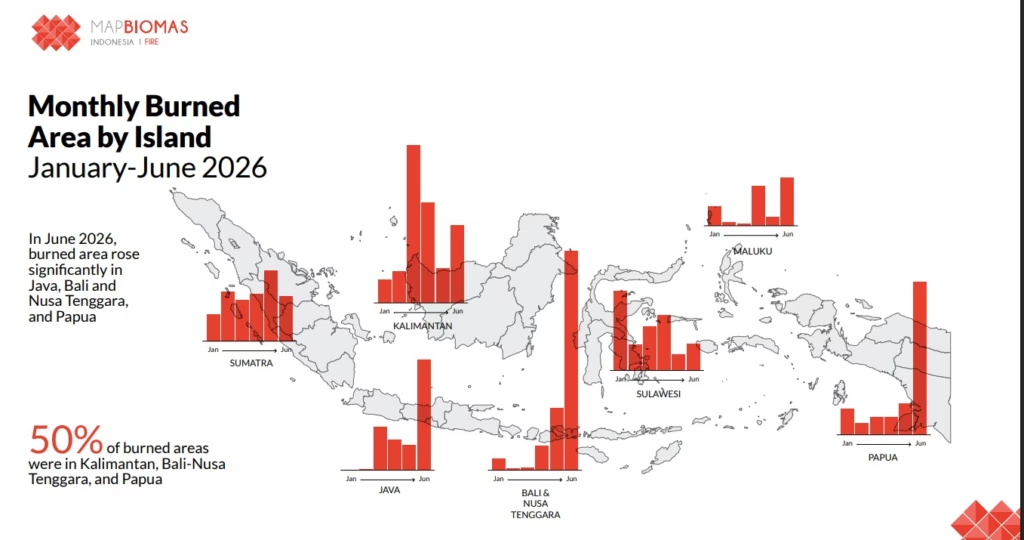
Looking at the eastern region collectively, the combined burned areas of Bali and the Nusa Tenggara islands reached 33,338 hectares. This figure represents approximately 18.7 percent of the national total, a contribution that is rapidly approaching the total burned area of the entire island of Kalimantan, which stood at around 21.13 percent.
Behind the Satellite Lens
One of the most glaring highlights of the 2026 findings is the significant disparity in monitoring data. While MapBiomas Fire reported 178,232 hectares of scorched earth, the Ministry of Forestry’s Forest and Land Fire Control Information System (SiPongi) recorded a much lower figure of 107,465.47 hectares for the exact same period.
This stark contrast is primarily rooted in differing monitoring methodologies. To detect fires, MapBiomas Fire relies on high-resolution Sentinel-2 satellite imagery combined with advanced deep learning models. This cutting-edge technological approach allows the system to meticulously identify burned areas across a much wider variety of land cover types, capturing fires that traditional systems might miss.
It is also important to note that the flames are not only consuming natural drylands. The MapBiomas report highlighted that at least 25,053 hectares of post-deforestation land in Indonesia burned between January and June 2026. For this specific post-deforestation category, West Kalimantan and Riau remain the top two provinces with the largest burned areas.
Landscape Characteristics and Ecological Blind Spots
Why did the burned area in NTT surpass the historically flammable lands of Sumatra and Kalimantan? The answer lies in the province’s unique natural characteristics. NTT is defined by its extensive savanna landscapes and non-forest vegetative cover.
Through refined satellite image classification, MapBiomas Fire is able to detect burned areas across highly diverse land cover classes—including non-rice agricultural lands, shrublands, and the vast savanna plains. The unique topographical and biological characteristics of these landscapes demand a paradigm shift in fire monitoring; one that is no longer rigidly focused solely on officially designated forest zones.
The surge of fires in eastern Indonesia is not merely a statistical issue regarding the sheer size of the blackened land. Beyond the numbers, the fires in the first half of 2026 have severely impacted several areas that hold vital ecological functions, threatening local biodiversity and the fragile balance of the dryland ecosystem.
Turning Our Gaze to the East
The data emerging from the first half of 2026 sends a clear and undeniable message: our vigilance and mitigation strategies for land fires must expand to encompass a broader geographic map. We can no longer view hotspots purely as an “endemic disease” of peatlands and tropical rainforests.
Fire monitoring and mitigation in Indonesia desperately require a more holistic approach—one that fully recognizes that the golden savannas of the East are just as vulnerable to the flames, and just as invaluable to save.
- An Urgent Plea for International Aid from the Heart of Indonesia’s Toxic Haze Crisis
- How the Savannas of Nusa Tenggara Became Indonesia’s New Epicenter for Land Fires
- Why World Mangrove Day Requires Action, Not Just Rhetoric?

- Fair Finance Asia Promotes Collaboration on Energy Transition
- The Smoke Crisis and Methane Time Bomb at Jatiwaringin Landfill
- One Year Since the Maba Sangaji Forest Tragedy